Firenze case study
Firenze is a representative European old city with strong historic character and substantial cultural heritage. Although, it is a medium size city, it needs to improve urban mobility as well as to limit emissions of air pollutants, to improve energy efficiency of public and private buildings, to decrease waste production and to raise awareness on environmental responsibility.

The case study comprises the future maintenance and development of Cascine Park. Considering the park’s historic importance, operations on the Cascine must take into consideration its cultural heritage character and the legal bindings connected to them, leaving scarce room for modifying the present asset of plants. Therefore, the following alternatives are proposed: (a) refurbishment and restoration of the park; and (b) refurbishment and restoration of the park and planting of new trees along the city streets and on public places (and consequent effect on urban canopy layer and removal of areas for traffic and parking).
The case study will be mainly assessed with regard to its potential impacts on air quality and thermal comfort generated by an increase of the number of trees.
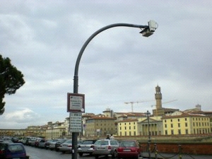
Measurements at Firenze are carried out with the use of a recently installed micromet monitoring system capable to record urban mass and energy fluxes. More specifically, an eddy covariance (EC) flux station was installed in Firenze (43° 47’ N, 11° 15’ E) in September of 2005 at the Osservatorio Ximeniano, in the center of the city and is operating from 14 September 2005. Air quality datasets for a network of 5 air quality monitoring stations (placed in urban road and rural area) are available from 1 January 2003.
A. In-situ datasets of air quality, energy, water, carbon and pollutants fluxes/concentrations
The following data will be provided:
- Time series and spatially extensive data sets of air quality and surface fluxes.
- Turbulent fluxes and distribution of trace gas and particle concentrations.
- Gas exchange of urban vegetation in relation to soil properties.
- Urban heat island characteristics and energy demand of buildings for cooling.
- Indoor environmental quality.
More specifically the collected data are:
Air quality:
Concentrations of H2O, CO2, NOx, CO, O3
Particle number flux (starting from 0.32nm)
Particle number size distribution
Principal outdoor pollutatnts (VOCs, contaminants, etc.)
Indoor air quality:
Particulate matter values - PM1, PM2.5, PM10
Principal indoor pollutants (NOx, VOCs, etc.)
Meteorological parameters:
Air pressure
Air temperature
Precipitation
Surface temperature
Micrometerological parameters:
All three wind components (u, v and w)
Friction velocity
Sensible and latent heat fluxes and CO2 flux
Turbulent fluxes
Plant:
Diurnal stem and bark diameter variation (6 trees)
Biomonitoring of airborne trace metals
Radiation:
Up- and downward long- and shortwave radiations + PAR
UVA & UVB radiation
B. Remote sensing and GIS data and maps of energy and water fluxes, pollution concentrations, land cover and vegetation, spatial and socio-economic development
The following satellite, airborne and GIS data, in order to produce maps of energy and water fluxes, pollution concentration, land cover and vegetation, spatial and socio-economic development, are available:
- Maps of sensible heat flux based on different modelling approaches
- Maps of surface emissivity by modelling and satellite data
- Particulate profiles and Planetary Boundary Layer characteristics by LIDAR
- Concentration of pollutants (PM10, CO2, NOx, SOx, CO)
- 3D maps of city
- Airborne images, orthophoto
- Digital Elevation Model (DEM)
- High resolution satellite data products
- Corine Land Cover 2000 database of Firenze
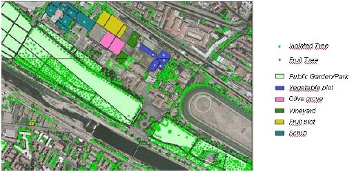
- Land use map of Firenze
- Vegetation map of Fiernze
- Digital topographic maps (roads/type, building type/height, green areas, etc)
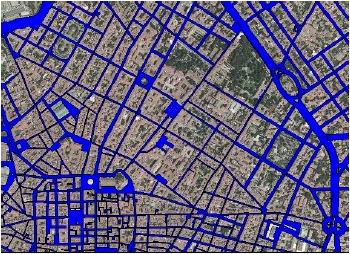
- Road Network
- Building and other structure
- Hydrography
- Infrastructure
- Divisor and ground element
- Terrestrial build
- Orographic element
- Administrative Limit/Units
- Toponymy
- Population census data


