Gliwice case study
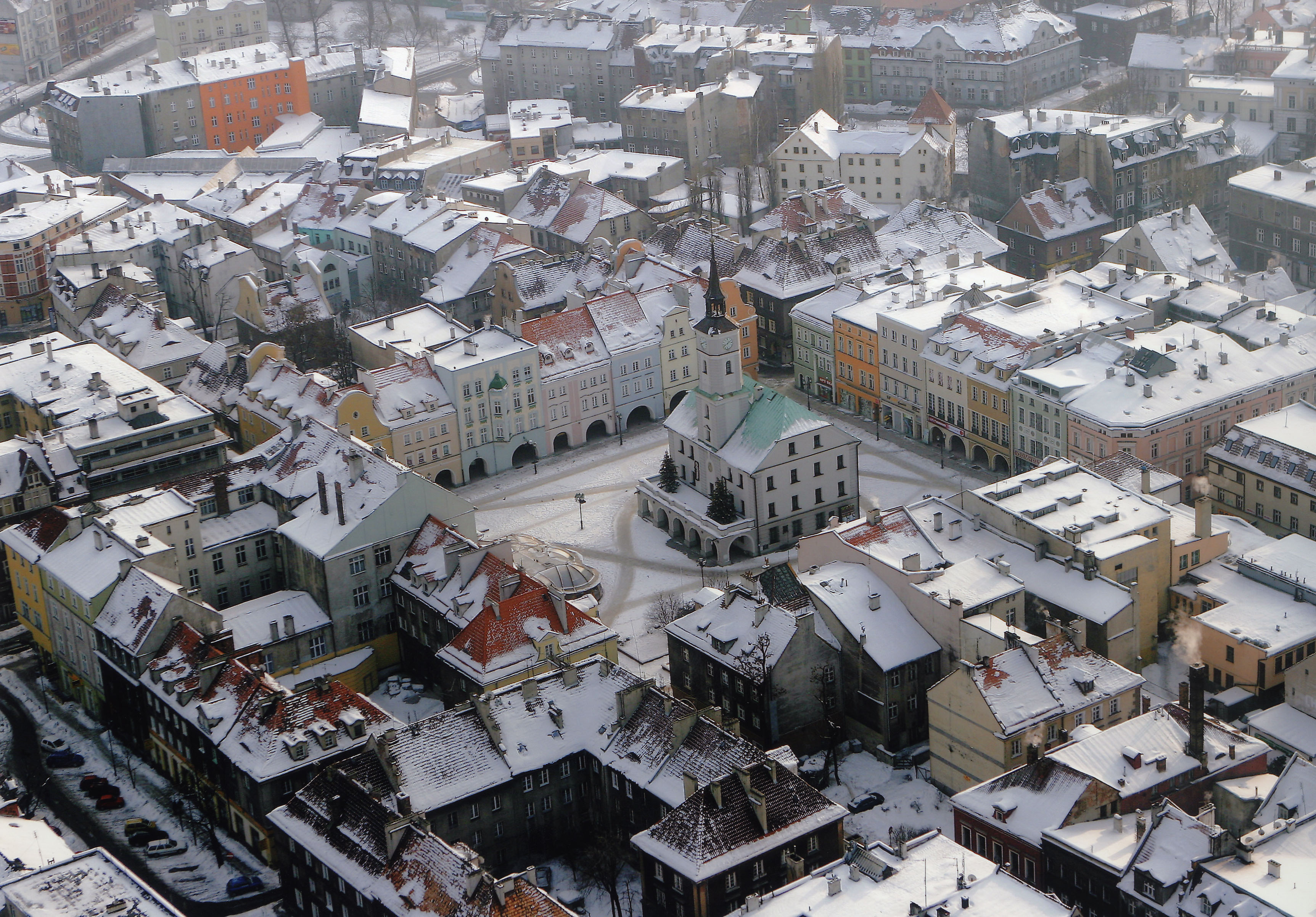
Gliwice is a representative Eastern European city with dynamic planning process reflecting the economical, social, and political changes held within last two decades. It is a satellite city with an Old Town in the central part and residential districts around the centre. Its challenges towards sustainability include the definition of land use plans, the improvement of buildings through technical and energy efficiency measures, the management of the quantity and quality of water, the protection of the water resources and the improvement in the traffic patterns. The area of Gliwice is 133,9 km2 and the total number of inhabitants amounted 191.232 in 2008 with decreasing tendency (100.149 woman and 91.083 man).

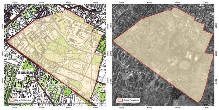
Although the Gliwice Town Development Plan is currently under discussion, there is a number of areas that need more detailed planning (i.e. will be subject to local area planning). These areas include the Kopernika housing district and the Academic district. There is a necessity to create a fully equipped campus at the Academic District. The challenge is the limited geographical extent of the district and the need to optimise space and solutions, as well as the environmental loads to the carrying capacity of the area. The planning alternatives include: a) the construction of the trunk road which will influence communication and accessibility to the district; b) the construction of the sports hall, which will entail an additional load of people in the area; c) the construction of a centre for new technologies, a 7-storey building incorporating sustainable energy use (e.g. heat energy from solar collectors, energy recovery, etc.); and d) the development of all the aspects considered in scenarios a) to c).
The case study will be mainly assessed with regard to the environmental load in the area (particularly from the point of view of emissions and resource use) and the transport and economic implications to the city.
The Gliwice Monitoring Station (part of the Silesian Air Monitoring Network) is located 1 km from the Academic District (Politechnika). An eddy covariance (EC) flux station was installed in Gliwice (50°16’45’’ N, 18°39’20’’ E) in December of 2009 on the flat roof of a 15 m high building close to the Gliwice Monitoring Station. The source area in easterly directions is dominated by urban area, while towards westerly directions rural areas prevail.
A. In-situ datasets of air quality, energy, water, carbon and pollutants fluxes/concentrations
The following data will be provided:
- Time series and spatially extensive data sets of air quality and surface fluxes.
- Turbulent fluxes and distribution of trace gas and particle concentrations.
- Urban heat island characteristics and energy demand of buildings for cooling.
More specifically the collected data are:
Air quality:
Concentrations of H2O, CO, CO2, NOx, O3, SO2
PM 2.5, PM10 concentration
Particle number
Indoor air quality:
Concentration CO2
Meteorological parameters:
Air pressure
Air temperature
Air temperature (next to trees)
Precipitation
Relative humidity
u, v components
Micrometerological parameters:
All three wind components (u, v and w)
Friction velocity
Sensible and latent heat fluxes and CO2 flux
Turbulent flux
Wind speed and direction
Radiation:
Up- and downward long- and shortwave radiations + PAR
Soil:
Soil moisture profile 4 depths
Soil temperature profile4 depths
Weather station
Temperature, rain, etc
B. Remote sensing and GIS data and maps of energy and water fluxes, pollution concentrations, land cover and vegetation, spatial and socio-economic development
The following satellite, airborne and GIS data, in order to produce maps of energy and water fluxes, pollution concentration, land cover and vegetation, spatial and socio-economic development, are available:
- Emission of PM10 from traffic (emission from state, provincial, county and city roads)
- 3D maps of city
- Corine Land Cover database
- Land use map of Gliwice
- Map representing extent of land use
- Aerial photo map (orthophotomap)
- Digital Elevation Model (DEM)
- High resolution satellite data products
- Population census data (population density)
- Number of inhabitants
- Number of flats heated by coal-fired boiler plant
- Number of flats heated by coal-burning furnace
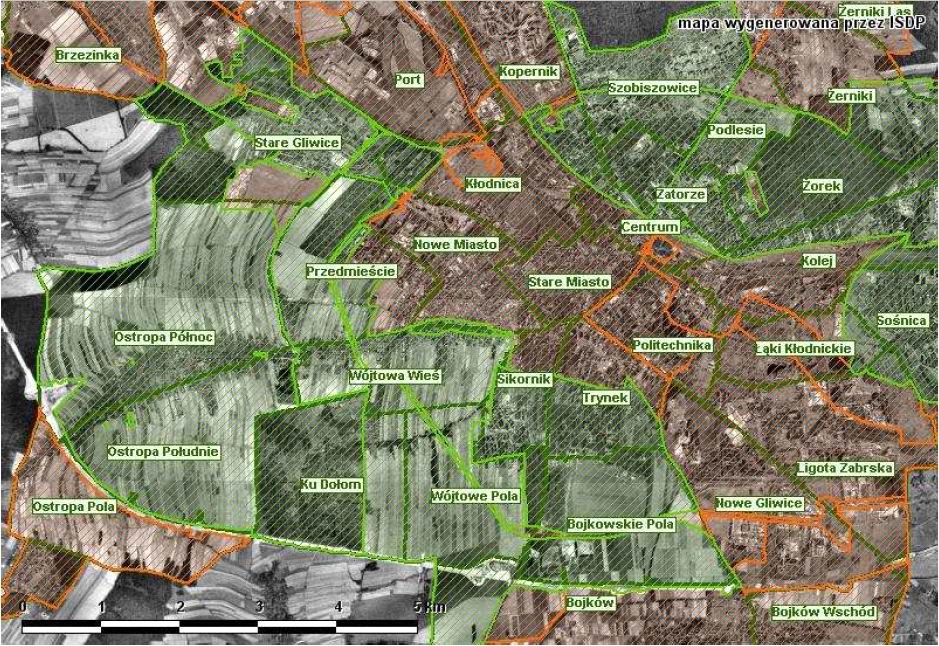
- Map of administrative boundaries (town, districts and geographical names)
- Gliwice municipal boundaries
- Preliminary map of the boundaries of Politechnika district
- Urban planning zones
- Map of address points
- Polish Hydrographical Map
- Polish Ecological Map
- Topographical maps
- Axes of roads (road network)
- Map of buildings (building type and number of floors)
- Networks of following facilities:
- waterworks
- sewage system
- central heating system
- gas pipelines


